However you say it, the world’s geology does not see political borders the same way us humans do. Rocks are inherently less territorial! Sure, we hear you shout “but some major political boundaries conform to rivers, mountain ranges and ocean margins”. This is of course true in some cases, yet for the most part, the subsurface is as continuous through space and time as the systems and processes that formed the continents and oceans.
This is particularly pertinent at this time of significant upheaval above ground, where political borders translated into the subsurface have created all manner of complex problems for those of us who like to look at the bigger subterranean picture. In this article, we take a quick look at the issue of naming strategies used on either side of the North Sea Median line, as a prime example of humans imposing their fence lines.
Well-meaning and often excited geologists are often keen to claim new and exciting discoveries. Sometimes this can be through bestowing the name of a dearly beloved on a sand body, or perhaps a nod to the nearest river, favourite tree or seabird.
This certainly makes life more interesting for subsequent users of the names. Younger geologists or newcomers to the industry from other realms such as finance frequently gain a great sense of well-being and personal discovery at cracking the codes used by historical operators and their well-intentioned subsurface teams. “Oh, pub names…of course”.
As a mature hydrocarbon province, the North Sea is peppered with such quirky nomenclature. Yet although well explored, 123 licences were granted in the 30th UK round and 33 in the recent 2018 APA round in Norway, showing there is clearly still a lot of interest from companies in maximising proven reserves and in making new discoveries in the North Sea. But how are people approaching this later stage of exploration and what can we do to improve the odds of success?
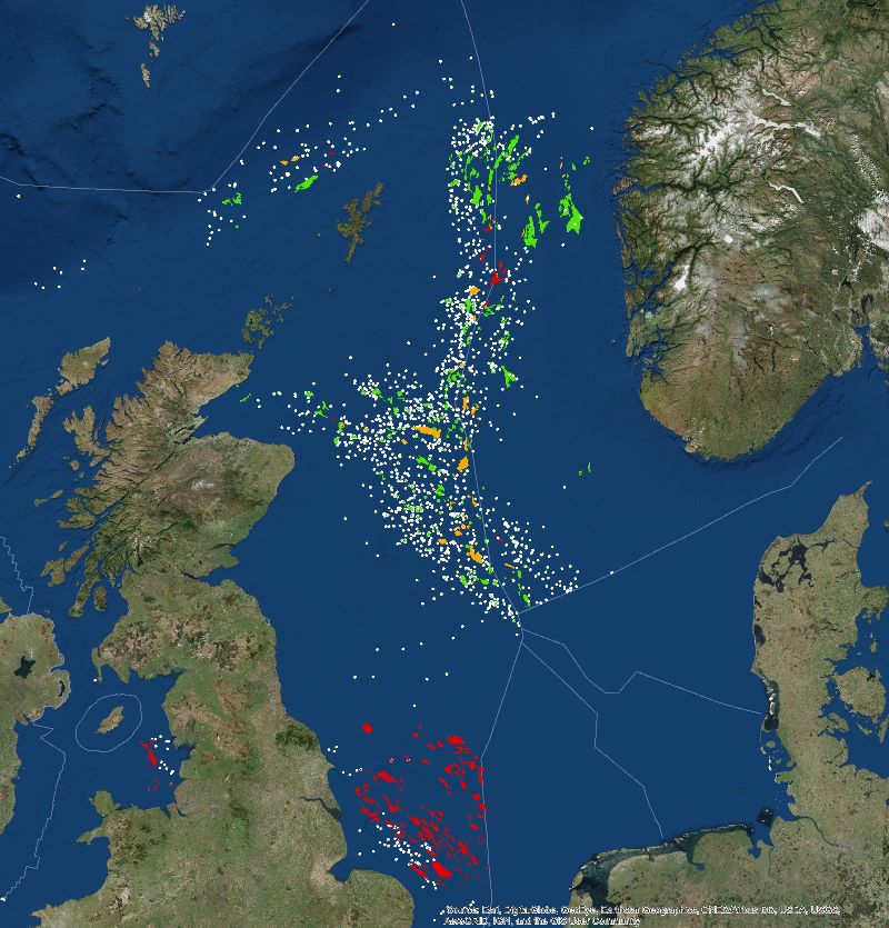
At Merlin, we have increasingly recognised the value in transferring knowledge across political boundaries. Indeed, in writing the Lower Cretaceous chapter of the Millennium Atlas, we simply had to look at the bigger picture as ancient turbidite fans don’t just stop at the median line! We have recently found this approach to be highly applicable to the Norwegian sector of the North Sea. In many ways, the geology of the North Sea is in essence, continuous, with similar deposits and settings on the UK and Norwegian side, yet we encounter many different names attributed to what is essentially the equivalent formation or sequence. A classic example is the “Intra Draupne Sandstone” in Norway, whose UK equivalent has numerous names including: the Brae Formation, Claymore Sandstone, Ettrick Sandstone.
A topical example is the case of many Upper Jurassic shallow marine sandstones on the Utsira High, that are prolific reservoirs in the Edvard Greig and Johan Sverdrup fields in Norway, where they lie directly upon crystalline basement. What is less well known is that age equivalent (but unnamed) shallow marine sandstones also occur in the UK sector, on the East Shetland Platform area updip of the Brae Field, in UK Quadrant 16. Does a similar play exist on the UK side of the Viking Graben?
For two decades, Merlin has provided geological support for projects spanning the UK/Norwegian median line; creating value through two centuries worth of experience. We already have more cross-border projects in the pipeline for the Central Graben and look forward to helping clients cut through the human-imposed complexities, to reveal the beautiful, and to some extent, predictable simplicity of the underlying petroleum systems.
As the theologian and philosopher William of Ockham succinctly asserted in the 13th Century, ‘simpler solutions are more likely to be correct than complex ones’. Geology is no exception. If we can make your life as explorers and appraisers easier and more successful, then that is precisely what we will do.
by Phil Copestake and Tony Loy, Stratigraphers

