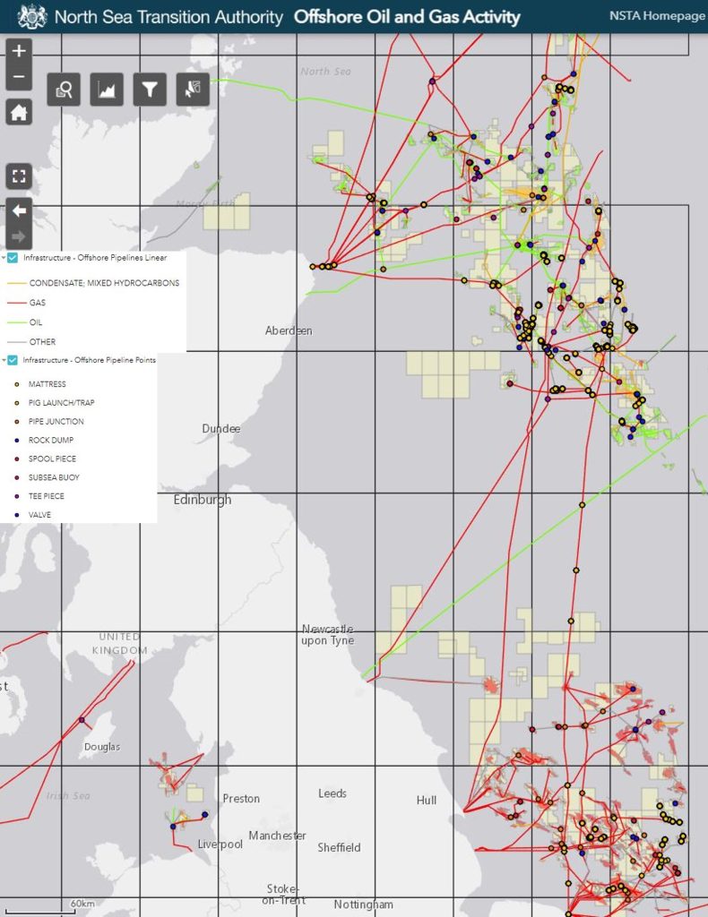
The first NSTA (North Sea Transition Authority) infrastructure reporting round of 2023 has recently completed, but as with all things concerning data, there is always more to do! Historically, the reporting of infrastructure has been a challenging task for busy companies to manage due to time and resource constraints. However, the importance of reporting a reliable, consistent, and useable dataset for infrastructure in the North Sea should not be downplayed. Common problems the NSTA have observed in previous reporting rounds include companies failing to report changes to their own infrastructure, failing to report changes of ownership of infrastructure, exacerbating the former problem, and major issues with infrastructure locations, e.g. mispositioned pipelines, wellheads not matching WONS etc. Therefore, in 2021, to try and mitigate against these issues and ease the process, the NSTA standardised the way infrastructure is reported. In addition, they are taking a much tougher line on companies who fail to report their infrastructure properly, adding an increased incentive to report all data and, importantly, report it correctly.
The infrastructure reporting round is a significant task, especially for companies with a large asset base. Historically reporting was done using spreadsheets (e.g. Excel), but recent changes require it to be reported in GIS geodatabase or shapefile format (you can read about Merlin’s GIS capabilities here). Reporting in consistent geographic coordinate reference systems has also been introduced, with only three accepted; ED50, WSG84 and ETRS89. The NSTA are actively amending the data schema and dataset categories that items are reported against. They have also added extra accountabilities for those responsible for reporting (the reporting group) which include running spatial checks on data before upload and ensuring that correct owners, operators, and holders for infrastructure are correctly identified. Once created, shapefiles/geodatabases are uploaded to the NSTA and run through a data validation process. This flags any items which fail the specified criteria. For example, items reported in the wrong category or which fall outside the required 5m location tolerance would come back to the reporting group as a failure. The issue then requires identification, rectification, and resubmission all before the final deadline, adding additional stress to the process.
These are just a few examples of changes companies have had to deal with over the last few years, but the process is ongoing with more updates scheduled. One key item soon to be made mandatory (potentially in the next round) is the reporting of infrastructure within the 500m safety zone around surface or subsea installations. Until now these data have been optional to report, but clearly when this change is implemented, it has the potential to create a huge workload for companies given the density of infrastructure present in these zones.
It may feel a while off yet, but there will be another reporting round to contend with in the autumn. Merlin have experience completing the reporting round for clients, easing their time and resource requirement in house. We keep up to date with the current NSTA guidelines and work seamlessly with client teams to understand their infrastructure and report it correctly within the timeframes set out by the NSTA. There is no time like the present to get ahead of the game, so get in touch to discuss ways in which we can help ease the burden of infrastructure reporting: info@merlinenergy.co.uk
To learn more about Merlin’s other data management services, see our Datawise division.
